
Research
Our research grounds machine perception in geometry and the physics of sensing, and treats sensing hardware, estimation, and learning as one co-designed system. The work spans new kinds of cameras and the lab-built platforms that carry them, large-scale aerial 3D reconstruction and digital twins, and perception for robotics partners across engineering. It is supported by federal sponsors including AFOSR, ARL, ERDC, and NGA.
Robotics perception
Robots are expected to perceive reliably in precisely the conditions under which conventional imaging is least informative. We treat this as a question about measurement rather than about data: what information a given sensor can recover about a scene, where that information degrades, and how an estimator should weigh it. Our work therefore grounds machine perception in scene geometry and in the physics of light and sensing, rather than relying on data correlations alone.
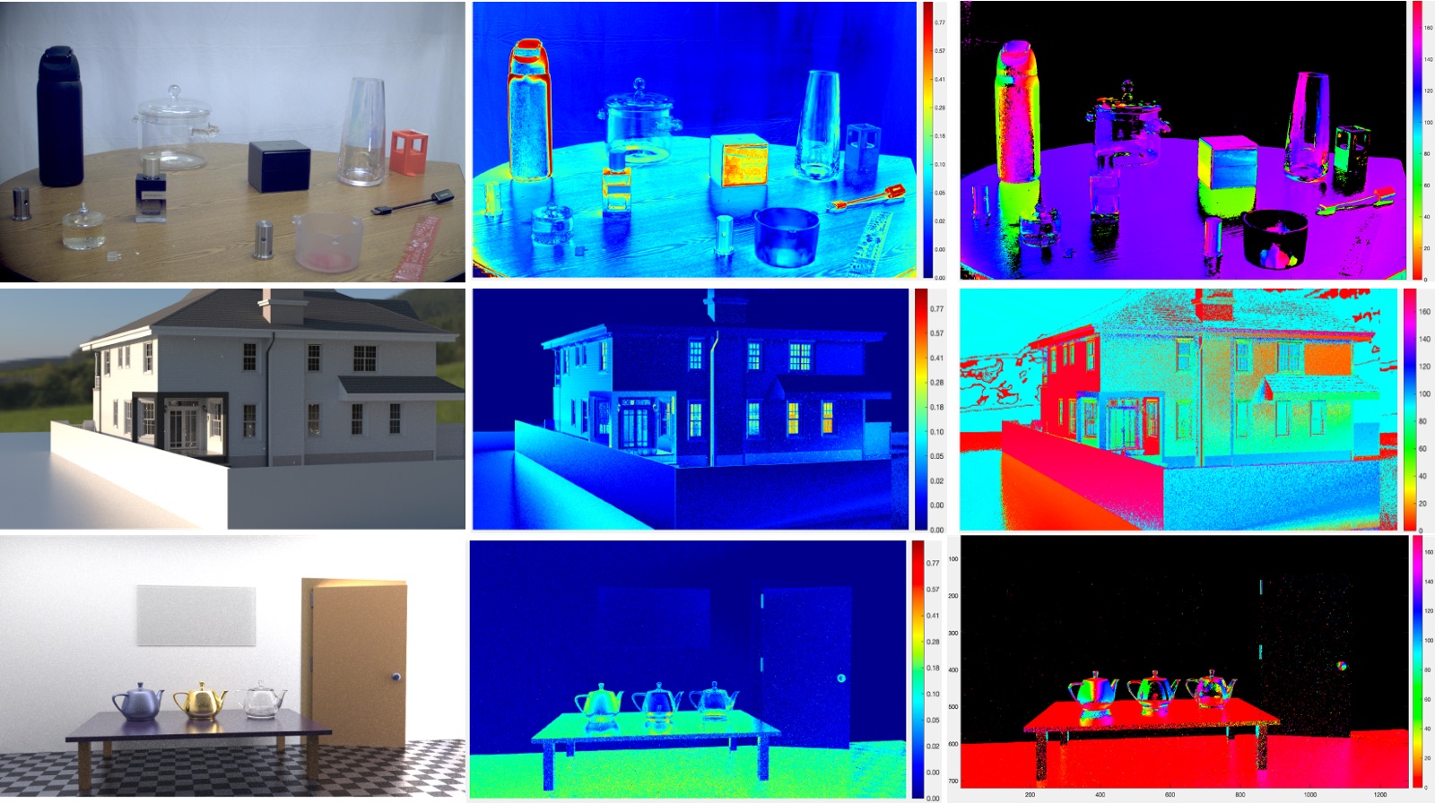
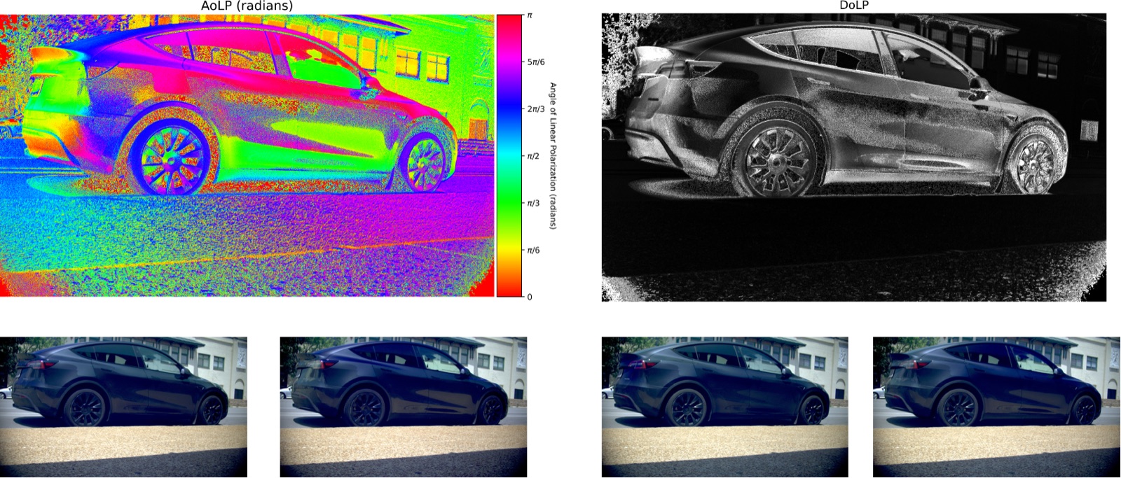
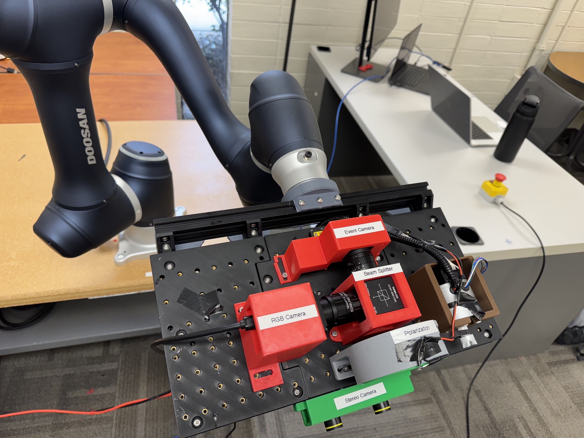
We combine conventional cameras with neuromorphic event cameras, which report per-pixel brightness changes with microsecond resolution and very high dynamic range, and with polarization imaging, which reveals surface orientation and material properties that intensity images miss. Sensing hardware and estimation algorithms are designed together: the lab builds its own multimodal sensing platforms and uses them to collect data, train physics-guided networks, and test where each sensor can be trusted.
The central question is how a machine can use physical understanding to decide what it knows about its environment, what remains uncertain, and how it should move or sense to gather better evidence.
Projects in Robotics perception
- PRoPE — physics-guided rolling polarization estimation — Estimating polarization from three closely spaced measurements instead of a full 180° sweep, for fast scenes and edge hardware.
- DensePol — dense-angle polarization dataset — A polarization dataset captured through 180 analyzer orientations per scene, making label quality measurable for learned polarimetric vision.
- TESS-Net — trust-aware event-guided deblurring — Estimating where event-camera evidence is reliable, then using it only there, to restore a sharp image from a single motion-blurred frame.
- EvSat3D — event-based satellite pose and 3D reconstruction — Recovering satellite pose and shape with an event camera under glare, saturation, and reflections that defeat frame-based methods.
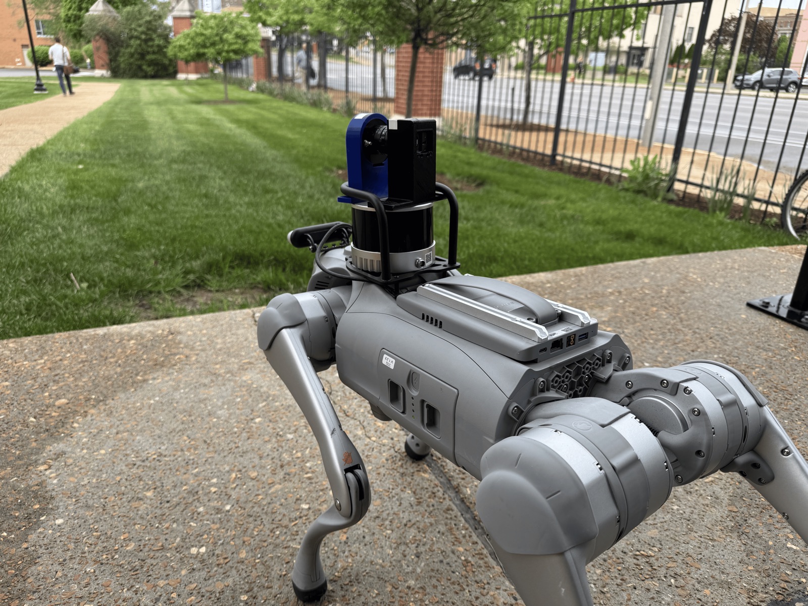
- AIRLab multimodal sensing platforms — An in-house RGB, event, and polarization sensing rig on an industrial arm, and a quadruped robot that takes it into the field.
- Shared autonomy for safe assistive manipulation — Robotic arms that combine brain, muscle, and eye-tracking signals to decide when to act on a user's intent.
- Language-controlled robots at the edge — Running large language models on-device so people can command mobile robots and robotic arms in plain language.
Geospatial AI and distributed aerial sensing
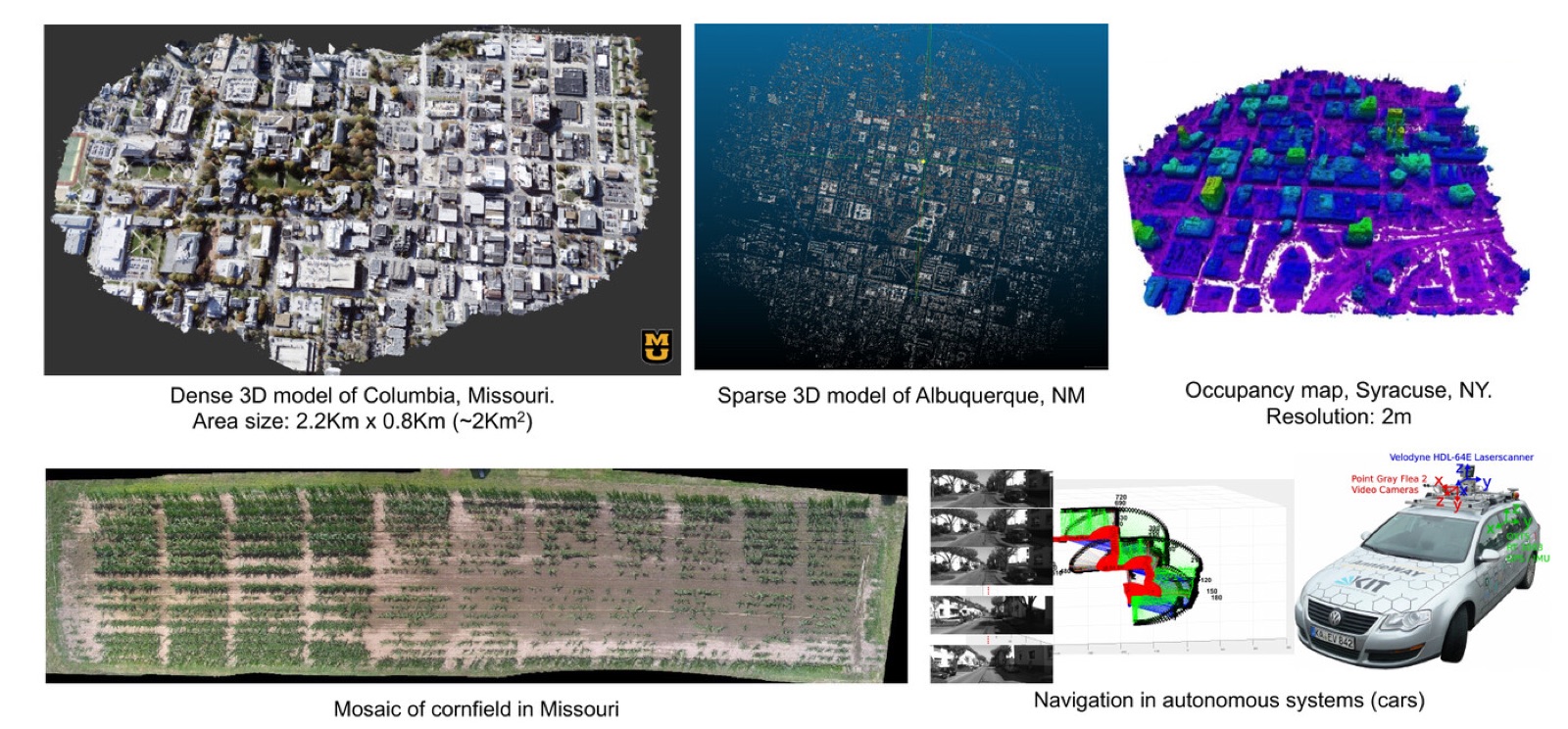
Airborne platforms produce far more imagery than their onboard computers and data links can handle, yet navigation and situational awareness need 3D geometry in near real time. We develop geometric vision methods that make large-scale aerial reconstruction fast enough to run on compact embedded GPUs.
A recurring theme is treating a team of small drones as one large, reconfigurable camera, and fusing visible and infrared imagery into a single, physically consistent 3D representation for day–night awareness. Building on this, we create 3D and multi-temporal digital twins of real environments from aerial, LiDAR, and event-camera data, with processing pushed to small, power-limited devices in the field.
This line of work has been supported by the Air Force Office of Scientific Research, the Army Research Laboratory, the U.S. Army Engineer Research and Development Center, and the National Geospatial-Intelligence Agency, and earlier results from it are patented and licensed to U.S. companies for drone-based sensing.
Projects in Geospatial AI and distributed aerial sensing
- Dynamic distributed-aperture imaging with small UAVs — Treating a team of small drones as one reconfigurable camera, fused into a single virtual focal plane (Light-Field Dynamic Homography).
- 3D fusion of color and infrared aerial imagery — Aligning infrared imagery with 3D scene models in both geometry and radiometry for day–night situational awareness (UDFP).
- EC-WAMI — event cameras for wide-area motion imagery — Using event-camera data to stabilize camera pose estimation in wide-area aerial imagery.
- Edge–high performance computing for multi-domain operations — Running demanding vision and AI workloads on small, power-limited devices in the field.
- Digital twins for geospatial intelligence — Building 3D and multi-temporal digital twins from event-camera, LiDAR, photogrammetry, and hyperspectral data, with analytics at the edge.
- Real-time aerial 3D reconstruction (BA4S) and technology transfer — Fast structure-from-motion for aerial video, patented and licensed to U.S. companies for drone-based sensing.