
Geospatial AI and distributed aerial sensing
Dynamic distributed-aperture imaging with small UAVs
Treating a team of small drones as one reconfigurable camera, fused into a single virtual focal plane (Light-Field Dynamic Homography).
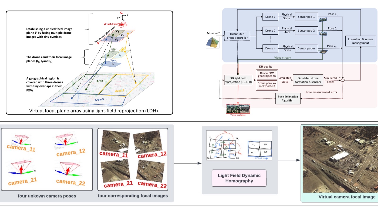
Small drones are cheap, agile, and easy to fly in numbers, which makes a fleet of them an attractive way to map large areas. The difficulty is optical: each platform carries a small sensor and a short lens, so each one sees only a narrow field of view. Wide-area, high-resolution imaging has traditionally been answered with large, heavy, expensive optics instead. This project reframes the problem — treat a team of lightweight platforms as one reconfigurable camera.
Why coverage and resolution pull against each other
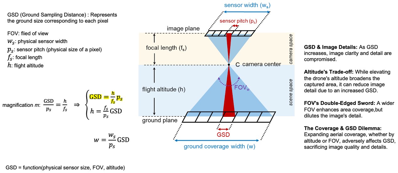
A single aerial camera cannot improve both at once. Ground sampling distance (GSD) — the ground size of one pixel — is fixed by the sensor’s pitch, its focal length, and the flight altitude. Climb higher and the field of view widens, so each frame covers more ground; but the same pixels are now spread over a larger area, so GSD grows and fine detail is lost. Widening the lens instead has the same effect. Coverage bought this way is always paid for in resolution.
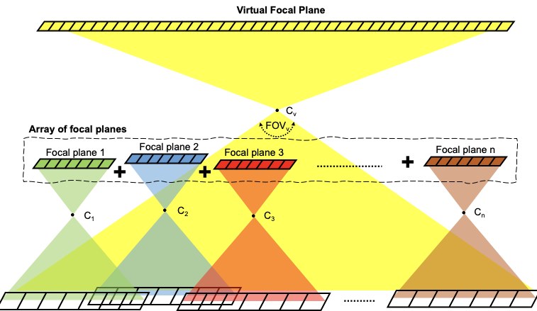
Combining the focal planes of several cameras breaks the trade-off rather than balancing it. The group covers a wider area than any one camera could, while each camera keeps its own focal length — so the GSD stays where it was and the detail survives.
Why existing multi-camera rigs do not solve it
Aerial multi-camera systems already exist, but their design assumptions are what make them unsuitable for a drone fleet:
- Stitching artifacts. Combining views by 2D image warping leaves visible seams and misalignment, and the error changes with scene structure and altitude.
- Fixed geometry. Cameras are pre-calibrated and rigidly mounted on a single platform, so the array cannot be reconfigured in flight.
- Specialized optics. Designs assume stable lenses and fixed focal lengths, which limits what the array can be used for.
- Calibration burden. Offline calibration is mandatory and slow, and it must be repeated after vibration, temperature change, or any mechanical knock.
- Narrow operating envelope. The combined focal planes are only optimal at the altitude and scene structure they were calibrated for.
- Cost. Taken together, these constraints make such systems expensive enough to rule out deployment in numbers.
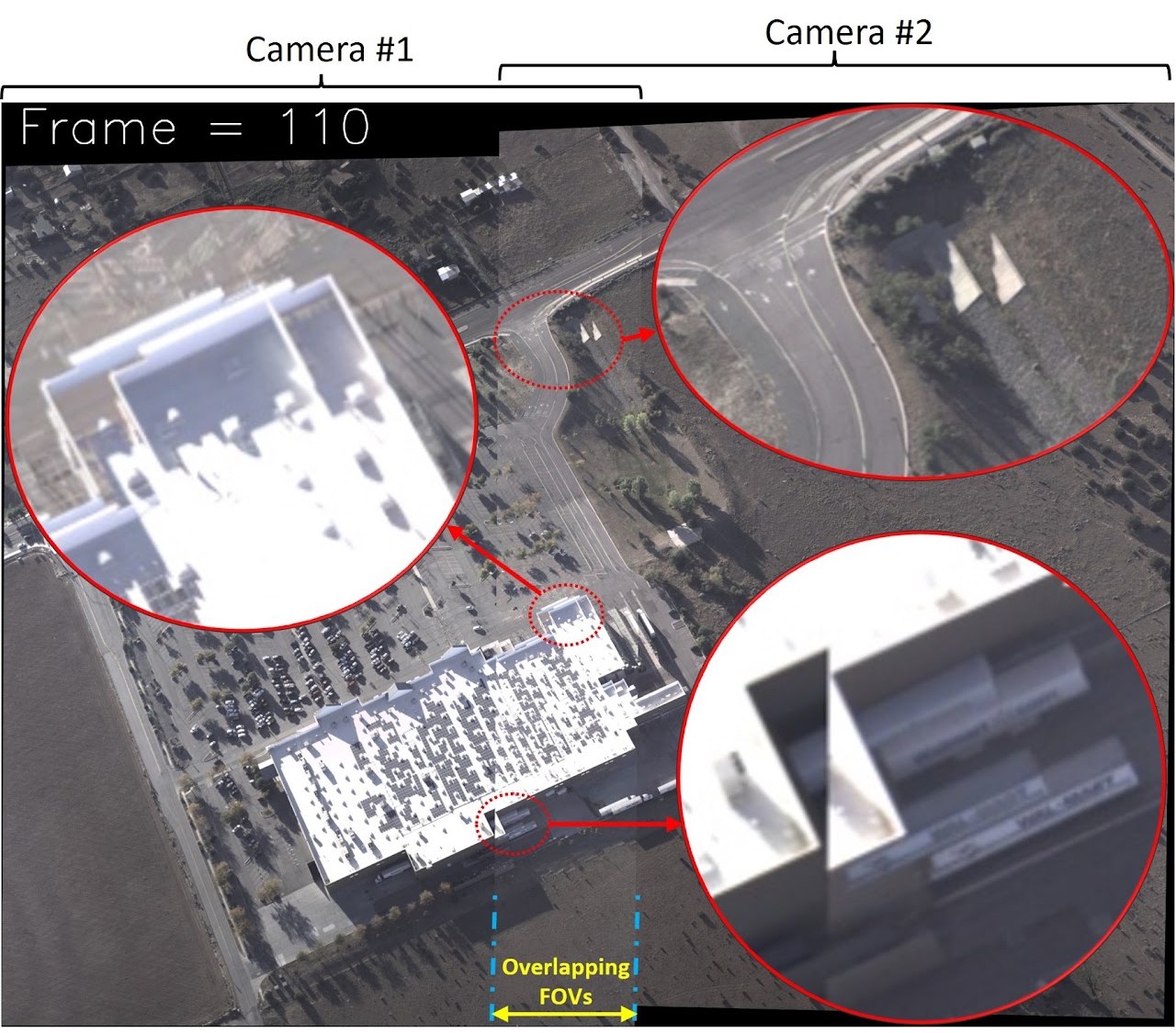
Even a two-camera setup drifts out of alignment under vibration and mechanical disturbance; the error also varies with scene structure and flight parameters.
A fleet of small drones violates every one of those assumptions: the cameras move relative to each other, their relative poses are unknown and changing, and overlap between views is minimal.
Light-Field Dynamic Homography
The Light-Field Dynamic Homography (LDH) framework estimates relative rotations, focal lengths, and lens distortion across a flexible camera array from very few correspondences, fusing images with minimal overlap into a single virtual focal plane. Because the geometry is estimated rather than assumed, the array can be reconfigured in flight and needs no rigid mount or repeated offline calibration.
LDH was validated in multi-drone simulation with coordinated camera placement and visual servoing, and is protected by U.S. Patent 12,555,185 B2 (2026). M.S. theses supervised in the lab extended it to visible–infrared registration and to virtual-camera generation from multi-UAV fleets.
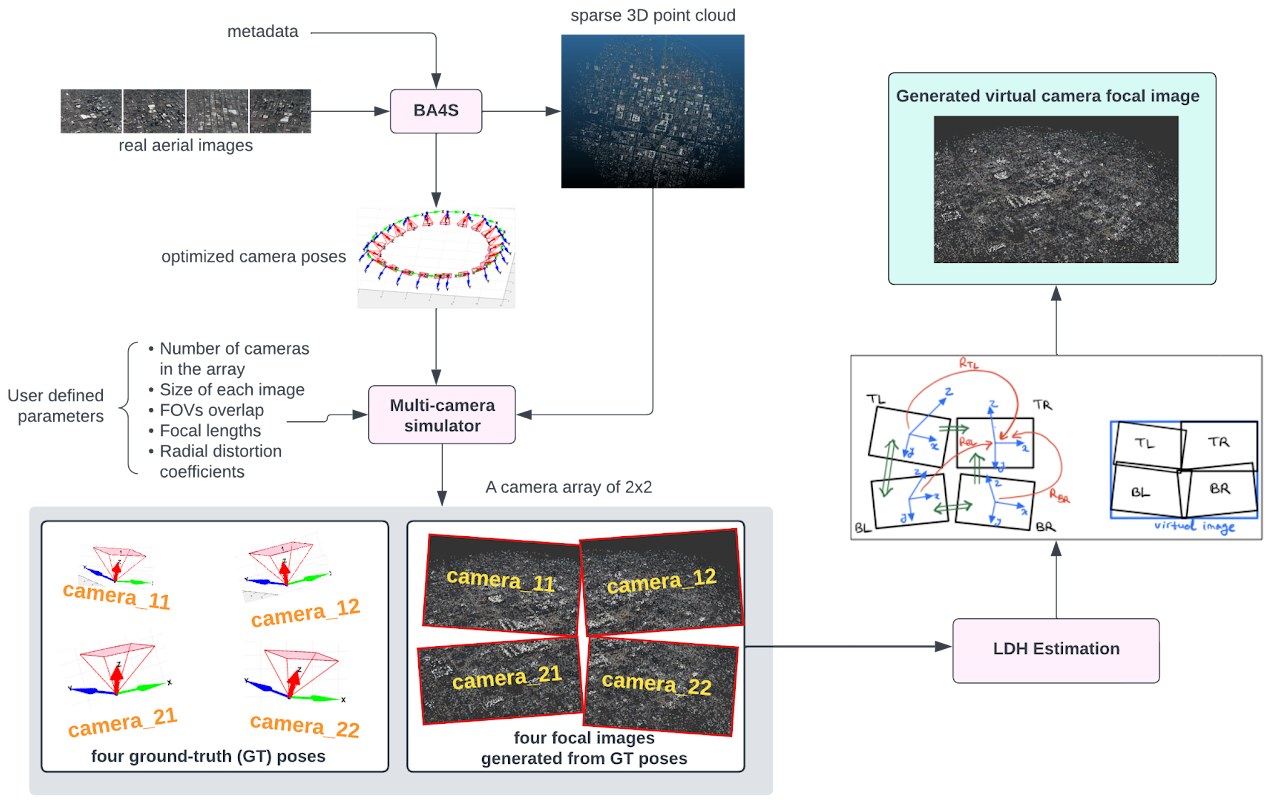
The evaluation pipeline. Real aerial imagery is run through BA4S to recover camera poses and a sparse point cloud; a multi-camera simulator then synthesises an array with known ground-truth poses, so LDH’s estimate can be measured against the truth.
Image: four cameras with unknown relative poses and small overlap fused into a single virtual focal image.
Publication
H. Ali Akbarpour et al. Flexible multi-camera virtual focal plane: a light-field dynamic homography approach. Scanning Technologies for Autonomous Systems, Springer, 2024.
Sponsors
- Air Force Office of Scientific Research (AFOSR)
- PI — FA9550-22-1-0406